what we do
Pick to learn more about the Acampo Innovation Project
〰️
Pick to learn more about the Acampo Innovation Project 〰️

2025 – FEMA Interior Sacramento Drainage Phases 1 thru 3
Hydraulic modeling and FEMA flood mapping was required for Levee Recertification. Project includes more than 10,000 acres and 10,000 drainage features in Sacramento including drainage basins 31, 34, 54, 91, 92, 95, 101, 103, 109, 140, 151, 152, 153, 157 & 158.
MRPE surveyed and modeled all stormwater storage and drainpipes, pumps, channels and roads that carry stormwater through these basins.
MRPE was selected as the most qualified firm to assist with one of the largest internal flood mapping efforts the city of Sacramento has undertaken in decades. Our proven system of providing more accurate and complete models was utilized for the majority of this work and will drastically improve the quality of flood information for a large swath of Sacramento.

2024 – LEAP Grant Modeling
The city utilized grant funds to promote the construction of low-income housing.
MRPE surveyed and created complete XPSWMM models for City drainage basins 102, 144, 154, 157, & 158. All 10 and 100-year deficiencies were reported.
To invest in the future development of low-income housing, the city selected MRPE and our proven process to generate accurate complete models. The models help the city and future developers assess and process related developments in these select basins faster and cheaper.

2023 - Navajo Pipelines Yard Expansion
Project expanded construction yard to include neighboring parcel.
MRPE surveyed, designed, and prepared plans and processed permits for road frontage improvements including driveway and ADA ramps, site improvements, building demolition, grading, frontage improvements and IOD preparation.
The regulatory experience of this Project was like a tragic comedy. This site adjacent to this construction yard had a dilapidated and abandoned building that was occasionally occupied by the homeless. The construction company purchased the property, but when they asked to demolish the building, the city deemed it historic and required a several month process to approve. In the meantime, the city fined the owner for homeless continuing to break and enter the property. The city ultimately required right-of-way dedication, fencing, landscaping, ADA improvements and more just to remove this building and utilize this lot.

2022 – State Capitol Annex
Project expanded the California State Capitol.
MRPE provided construction staking and collection of utilities exposed from potholing operations.
MRPE is uniquely qualified to assist with potholing operations like this because of our extensive background with utility design and research.

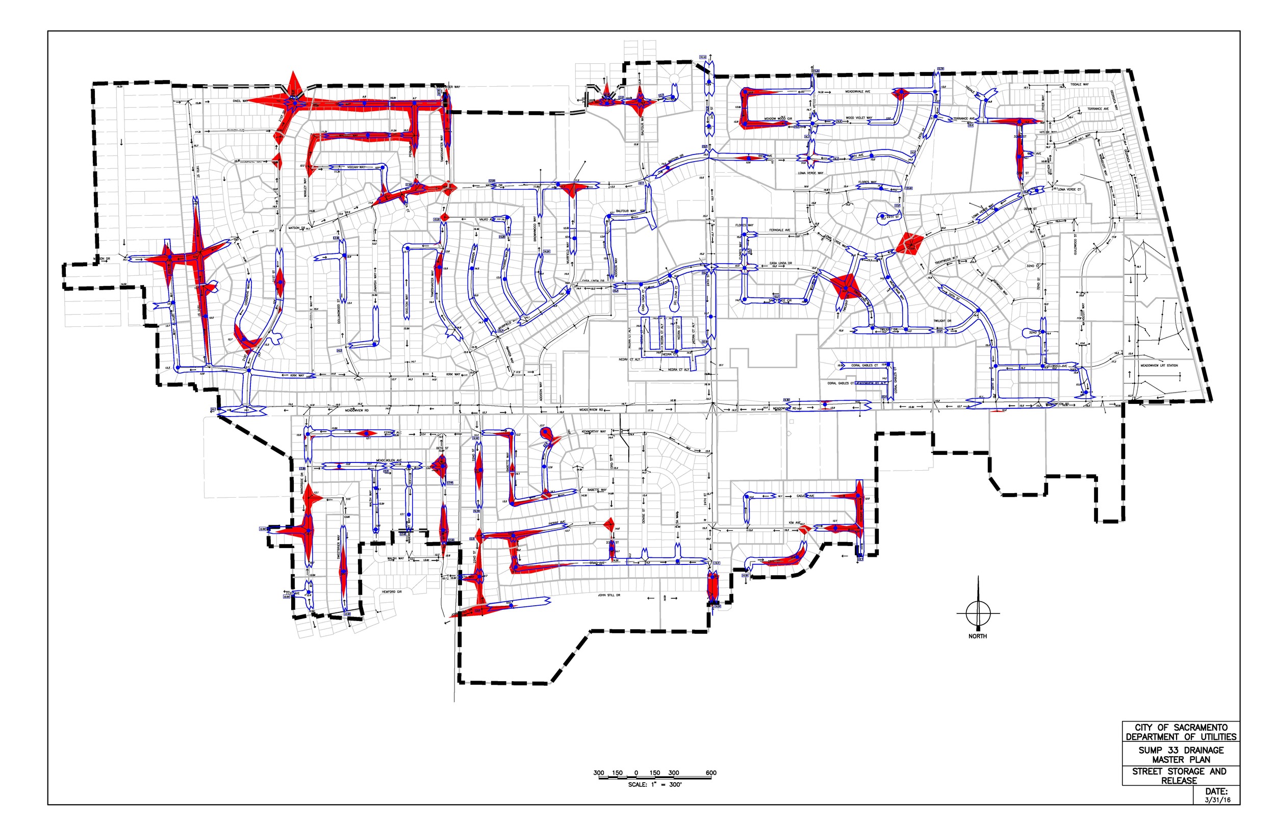
2019 – Basin 33 & 34 Drainage Masterplans
The city wanted to update old drainage masterplans for improved accuracy and completeness utilizing the system MRPE developed for Basin 129.
MRPE surveyed and performed hydraulic and hydrologic modeling, prepared, and mapped flooding. MRPE surveyed and created a complete model for Basin 34, as well as a floodplain analysis for future FIRM mapping. Basin 33 model was converted from SSWMM to XPSWMM with an updated datum. All deficiencies within both basins were identified.
Our surveying and data analysis methods were refined as we created another complete model with all conduits and field-surveyed roads. A uniquely accurate two-way dynamic stage flow hydrograph method was derived to account for back-and-forth overland releases between neighboring basins.

2017 - Basin 129 and 147 Drainage Master Plans
City wanted to create new models and master plans for these small and large basins comprising approximately 1500 acres.
MRPE surveyed and created a complete XPSWMM model for both basins. All deficiencies were identified, and alternatives were compared. Recommended CIP projects were provided including construction and long-term cost estimates.
These were the first complete City models of an existing basin to include all roads and conduits, as well as all storage outside the roadways. These were also the first models prepared for the City with all road gutter elevations field surveyed. MRPE utilized modern technology to create a system to accomplish this for about the same effort as prior approximate and incomplete models.
2016 – Basin 33 Drainage Study
The city wanted to improve the quality and completeness of this historic SSWMM model.
MRPE iteratively incorporated various modifications and additions to the model as requested, analyzed the results and prepared a report.
This was the first time MRPE started experimenting with new methods to create large models of existing city drainage infrastructure. The model accuracy and completeness were greatly improved from around +/-2' to +0.5' and from about 25% to 90% complete, but the real value was planting the seeds for ideas that would revolutionize the quality, completeness and efficiency of future MRPE models (see Basin 129 & 147 masterplans).
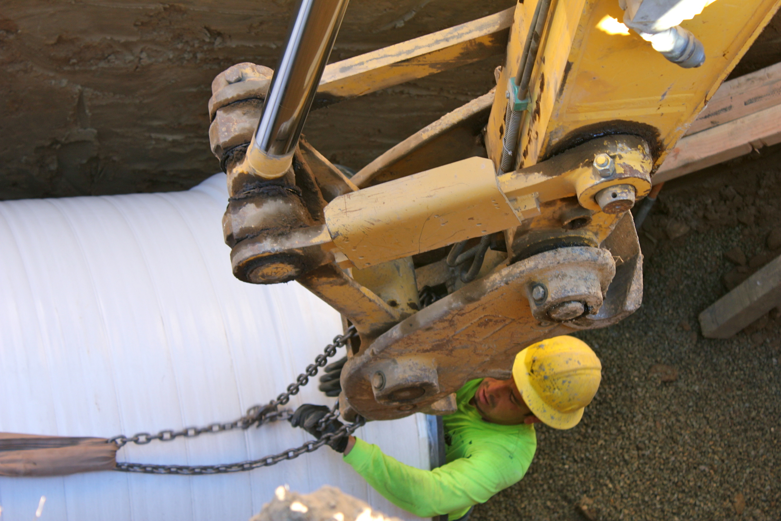
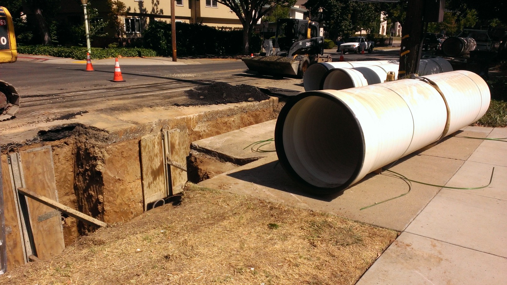
2014 – 65th Avenue Storm Drain Diversion
Place half mile of new 54" storm drain diverting stormwater to reduce flooding.
MRPE surveyed, designed, drafted plans and supported construction of this drainage pipe from 65th Avenue to a future detention basin in 24th Street.
This project utilized MRPE background from the Basin 54 drainage study along with surveying and design skills to rapidly complete this pipe extending through roads and private properties.
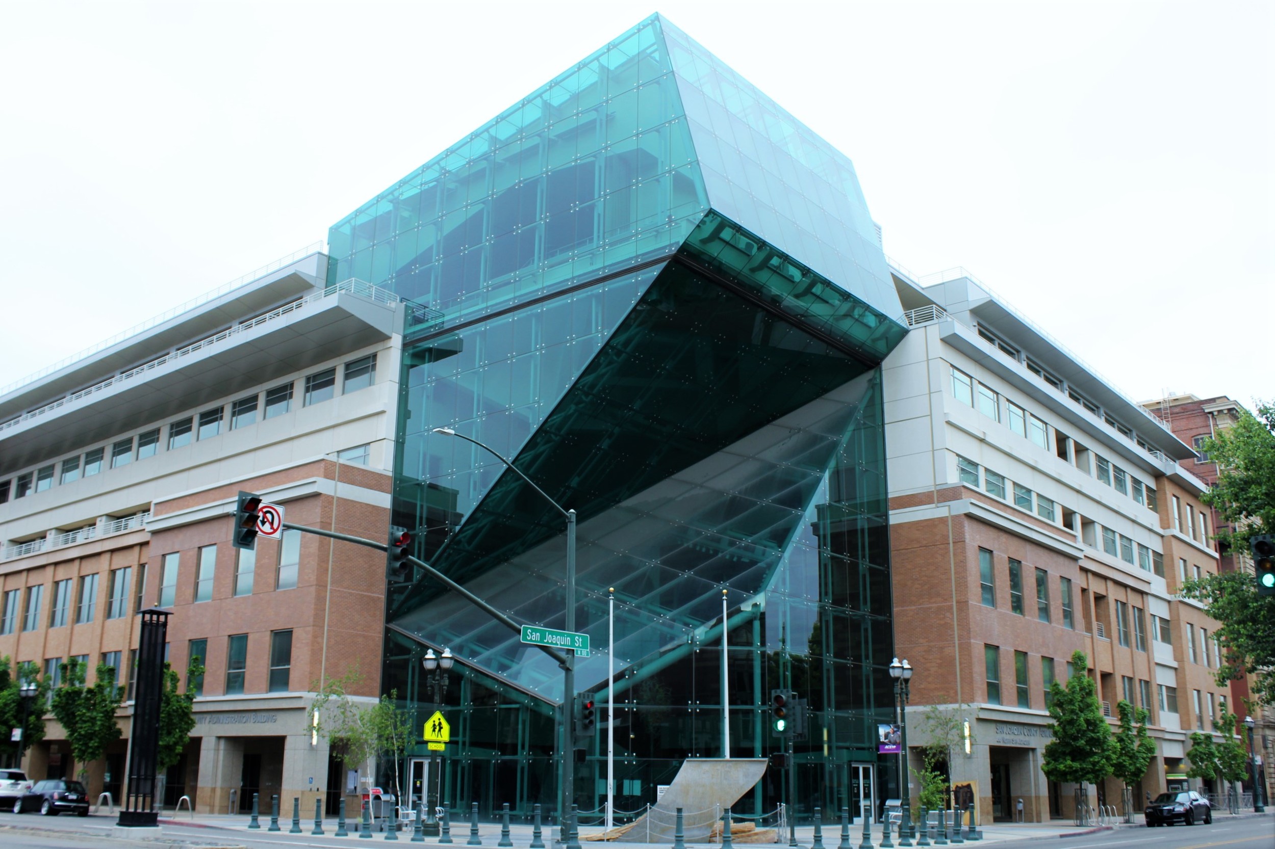
2008 – San Joaquin County Administration Building
This project was to construct a new San Joaquin County Administration Building in Stockton, CA
MRPE surveyed the site during construction and analyzed the plans prepared by others to determine resolution to grading and drainage design errors. New grading and layout plans were provided for all site grading and frontage improvements.
This project was under construction and the foundation was in when they realized that the grading was not going to work as designed. MRPE also found significant road frontage design errors and omissions resulting in a completely new design prepared in about a week that the engineer a of record ultimately adopted, signed and stamped.
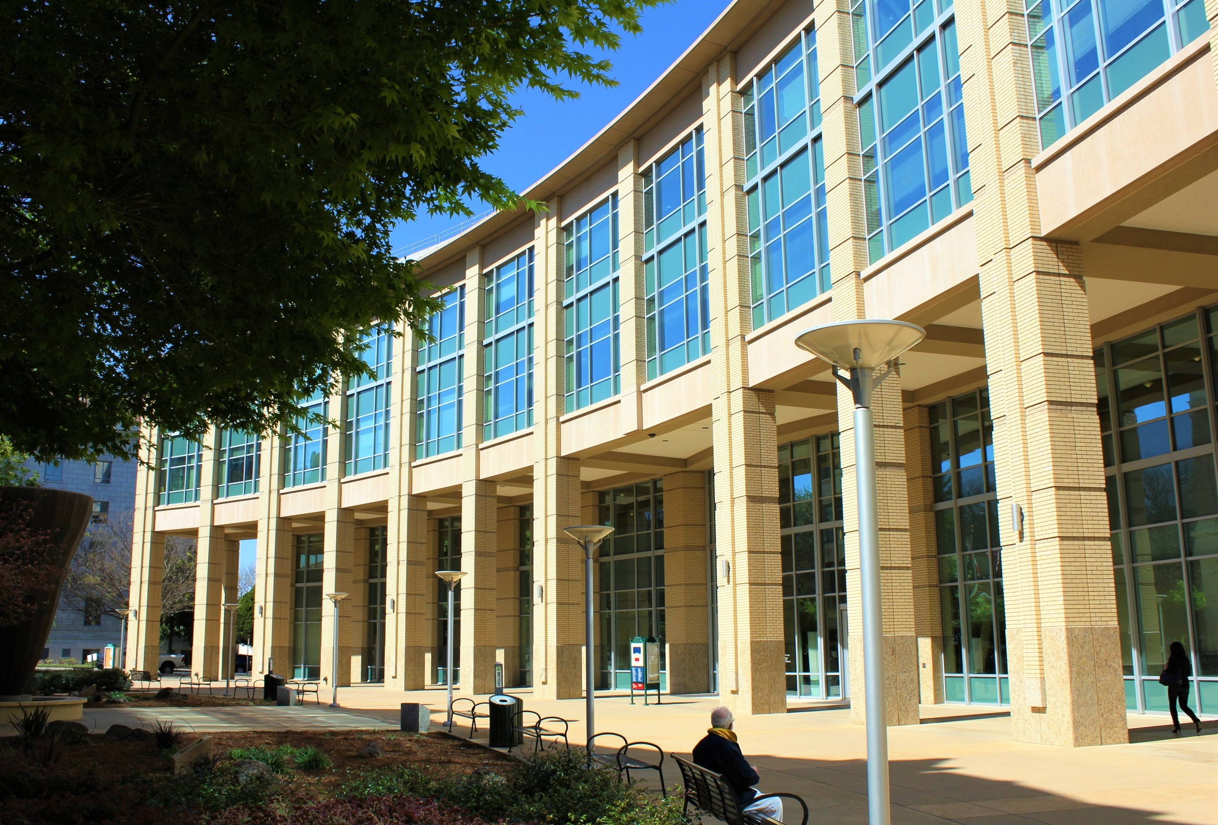
2004 – Sacramento City Hall
This project was to construct a new City Hall for the city of Sacramento adjacent to the historic city hall.
MRPE surveyed the site during construction and analyzed the plans prepared by others to determine the source of a 10' horizontal bust found during construction. New grading and layout plans were provided for all site grading and frontage improvements.
This project was under construction and the foundation was in when they realized that the loading ramps did not align with the docks on the building. The contractor and engineer had established different controls that go applied differently without the contractor's awareness. MRPE also found significant grading errors and omissions resulting in a completely new design prepared in about 48-hours.
2003 – Lakeside Cemetery Mapping
Create modern map of historic cemetery, including property, easements and individual plots for recordation.
MRPE researched, surveyed and mapped properties, easements and grave sites, utilizing historic records and physical evidence. This was the second of several projects performed for this cemetery owner.
This cemetery was more than 150 years old and had no measurements for the location of any of the thousands of occupied and purchased vacant grave sites.
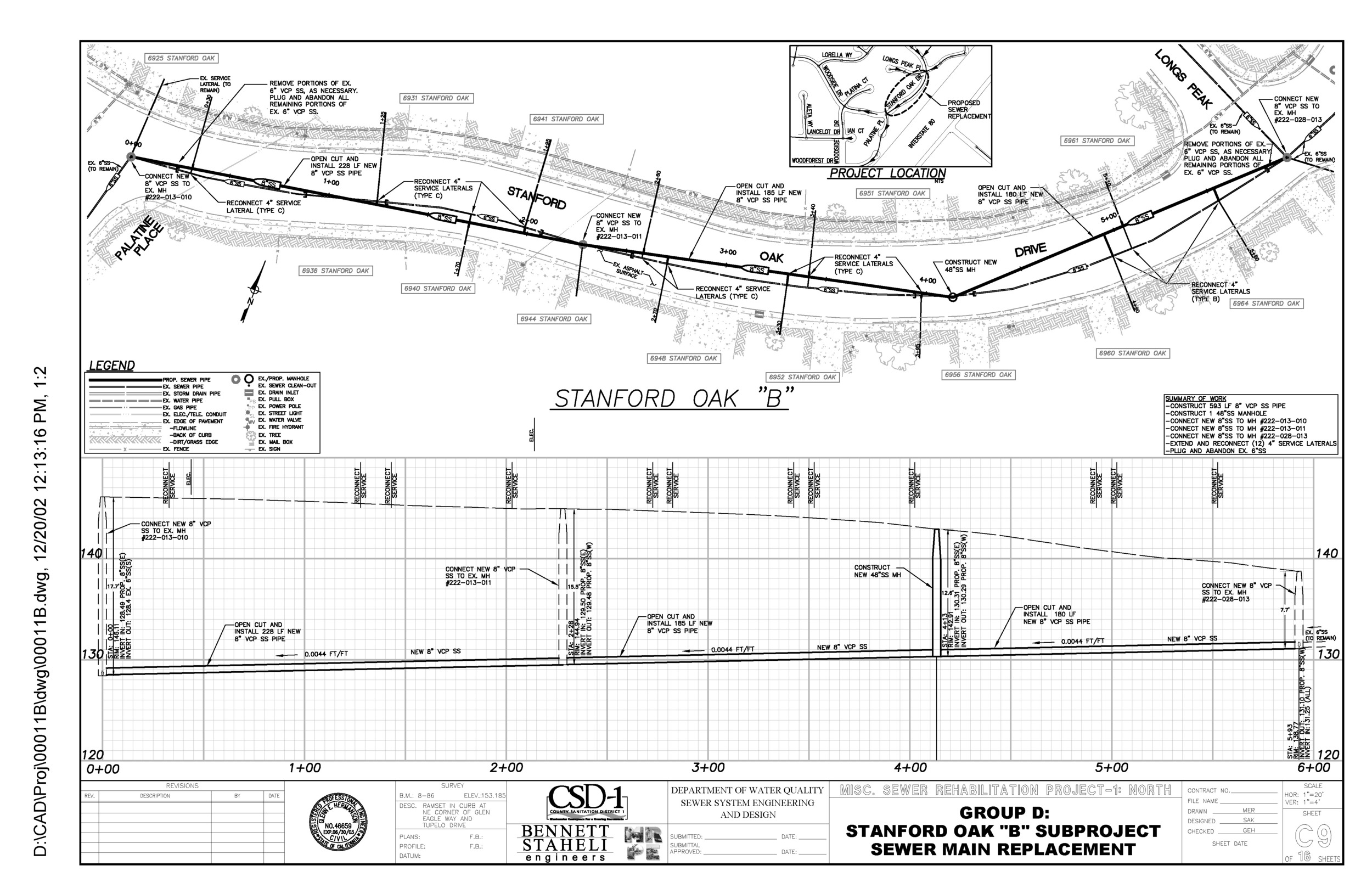
2002 – Misc. CSD-1 Sewer Rehabilitations
Replace or repair various sewer pipelines throughout Sacramento County
MRPE provided Land Surveying, Mapping and drafting of plan and profile drawings
Several of these sewer lines were difficult to access requiring different types of trenchless solutions

2000 – Trunk Sewer Crossing I-5
Feasibility study for micro-tunneling new 84" Combined Sewer Pipeline crossing under I-5 “boat” section
MRPE surveyed Freeway and adjacent properties at crossing, mapped topography and drafted plan & profile drawings
Freeway access required an encroachment permit and specialized safety training. A variety of improvements impacted alignment thru the Freeway and on either side including thickened concrete designed to prevent flotation of freeway during shallow groundwater.

1999 – Basin 69 Detention Basin at Cosumnes River College
Construct 10 acre Stormwater Detention Basin supporting dual use soccer field and softball diamond, Includes running track, ramps, inlet/outlet structure, pipes up to 84" in diameter, planting and irrigation.
MRPE provided project management and negotiation of agreement between college, Parks and Utilities Departments, land surveying, design and preparation of plans and specs, and bidding and construction support.
MRPE drastically reduced costs for Utilities Department client by getting land dedicated for free by College, and maintenance for free by Parks and College by exchanging another park site and providing specialized mowing equipment.

1998 – Tahoe Park/Broadway Parallel Sewer
This City of Sacramento Combined Sewer improvement included more than two miles of pipes up to 60” in diameter, micro tunneling thru the intersection of Stockton & Broadway and almost a hundred new sewer services and drain inlets.
MRPE provided land surveying, topographic mapping, design and plan preparation for most related improvements, which included a new basketball court in Tahoe Park.
This was one MRPE’s first projects. We provided a significant portion of the work for a small portion of the fee debuting what would become our standard.